Before you break ground: The essential guide to starting any project right
Written by
24 January 2026
•
7 min read
Everyone has heard a horror story. A boundary misread. A setback misunderstood. A wall constructed a few hundred millimetres too far over a line that, it turns out, mattered very much. In the worst cases, whole buildings have been found sited in the wrong place and the only path to compliance has been demolition. These stories circulate through the industry like urban legends, but they’re real, and they usually begin with the same omission: no survey at the beginning of the project.
To better understand the risks of not getting a survey, the information a survey encompasses, and which types of surveys are available, we spoke to surveyors Tristan Smythe and Brandan Bowd from C&A Surveyors, who reveal why surveying isn’t just about lines on a plan, it’s a crucial form of risk management.
The overlooked first step: a site survey
Because a survey isn’t strictly required at the outset, it’s easy to understand why some projects bypass it, particularly when budgets are tight and feasibility is still often being tested. At that early stage, the cost of engaging a surveyor can feel like an expense you might be able to avoid.
But what feels optional at the beginning can become critical at the end, as Brandan explains.
“If it's cut out at a feasibility stage and then just ignored for the rest of the project, it's almost always the case on the back-end that there are delays and missed things, especially in relating to titling and boundaries, which can result in some pretty hefty consequences at the back end of a project where interest on building loans comes into play.”
A survey provides key information on contours, adjoining site information, boundaries, easements, services, and existing structures, which are all elements that dictate what can be built on the site and where. Whether you’re adding a granny flat, developing land, or altering an existing structure, it’s crucial to have all of the information before moving to the design stage.
The real risks of not engaging a registered surveyor
Not all surveyors are created equal and that distinction matters more than many clients realise. Only a registered surveyor is legally permitted to determine property boundaries. Anyone else, regardless of experience or confidence, is operating outside the framework that makes surveying work legally valid.
As Brandan from C&A Surveyors explains, boundary definition is not just a technical exercise, it’s a regulated one. “It’s only a registered surveyor in New South Wales, who can determine or investigate boundaries. If it’s not a registered surveyor signing it off, then it’s not a legal definition.”
The risks that flow from getting this wrong are significant. Boundary inaccuracies can quickly escalate into neighbour disputes, particularly once construction begins and physical structures are involved. A development application may be rejected or stalled if survey information doesn’t meet council requirements, causing delays that ripple through the entire project timeline. In more serious cases, errors can lead to litigation, stop-work notices or even demolition orders.
There’s also a less visible, but equally critical, issue: insurance. Surveying work carried out by someone who isn’t registered isn’t covered in the same way, even if the measurements happen to be correct. Without the legislative backing that registration provides, the work effectively exists outside the system. If something goes wrong, there may be no professional indemnity protection to fall back on.
Brandan says that this is particularly common at the smaller end of the market, where homeowners are navigating early feasibility or minor works.
“Unregistered operators can appear more affordable and are often engaged for projects that don’t immediately pass through council, but affordability at the front end can come at a steep price later,” he says.
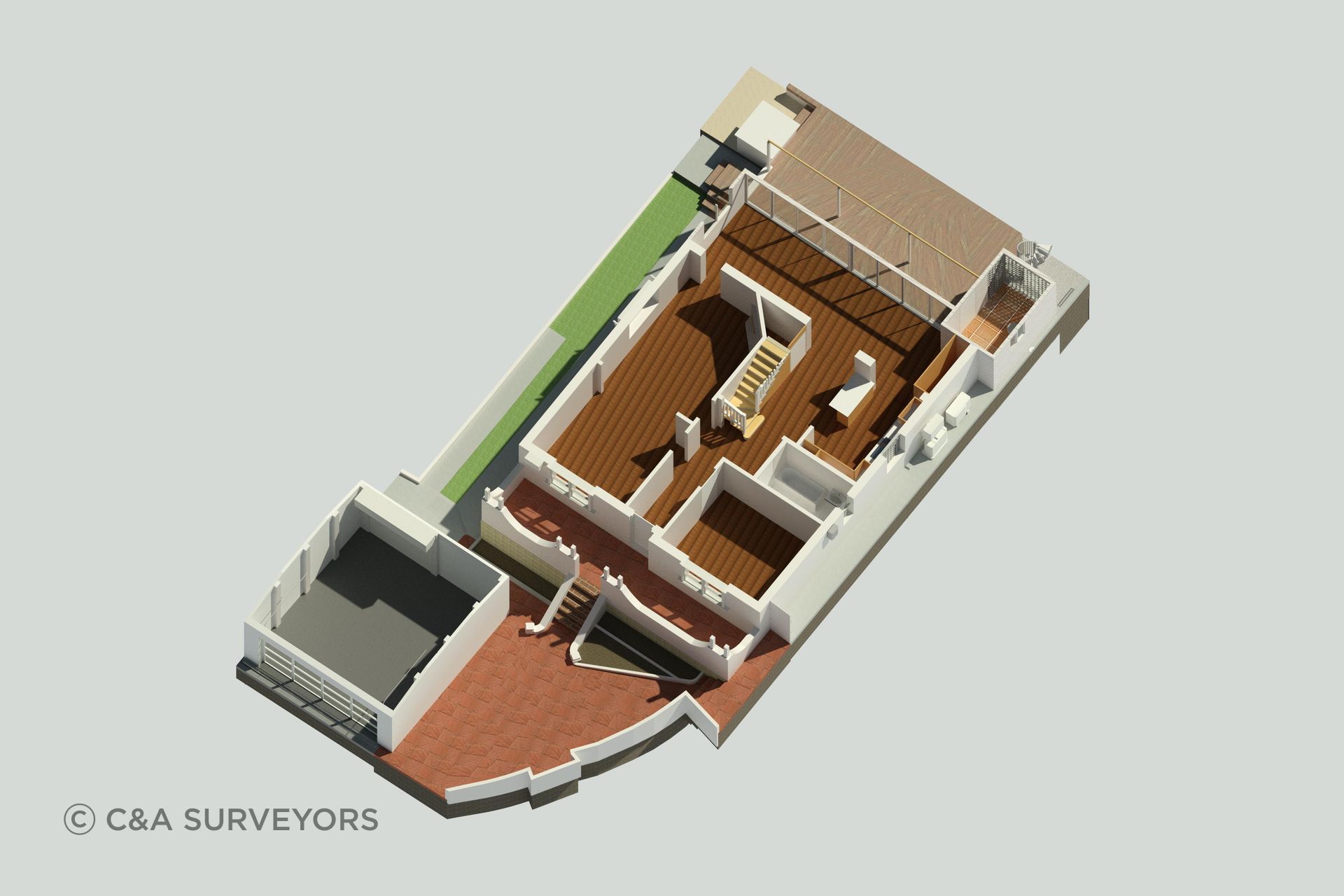
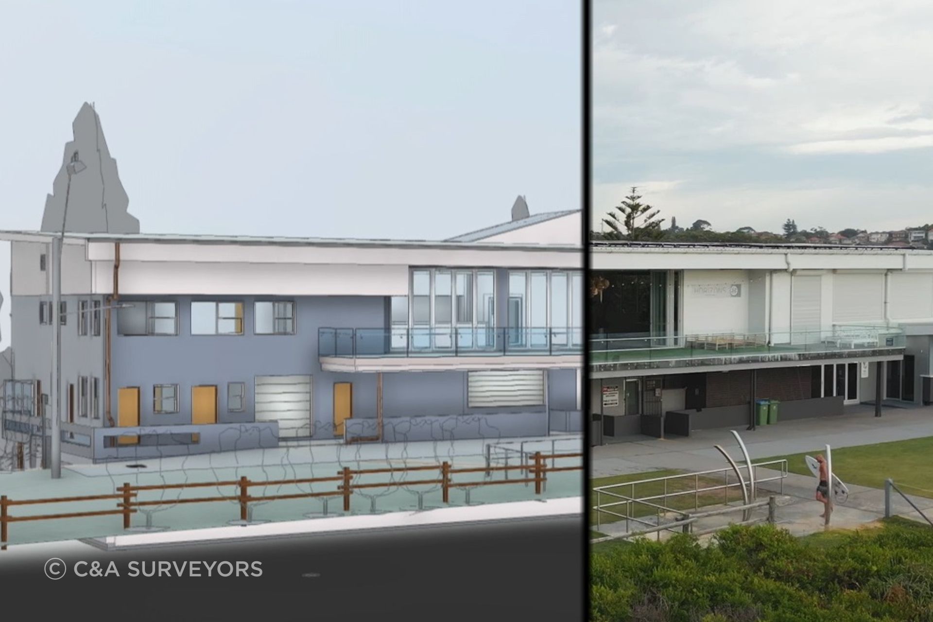
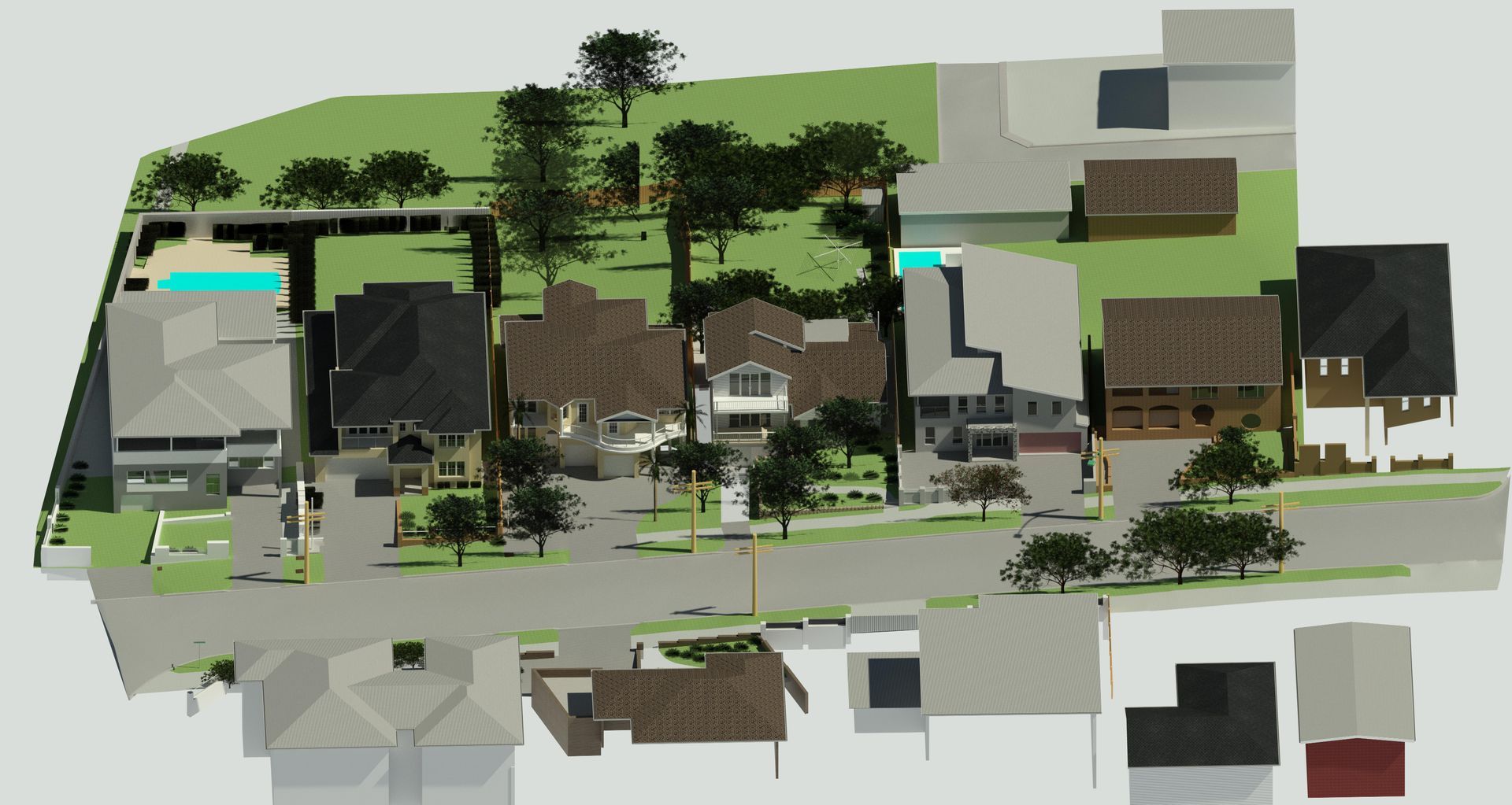
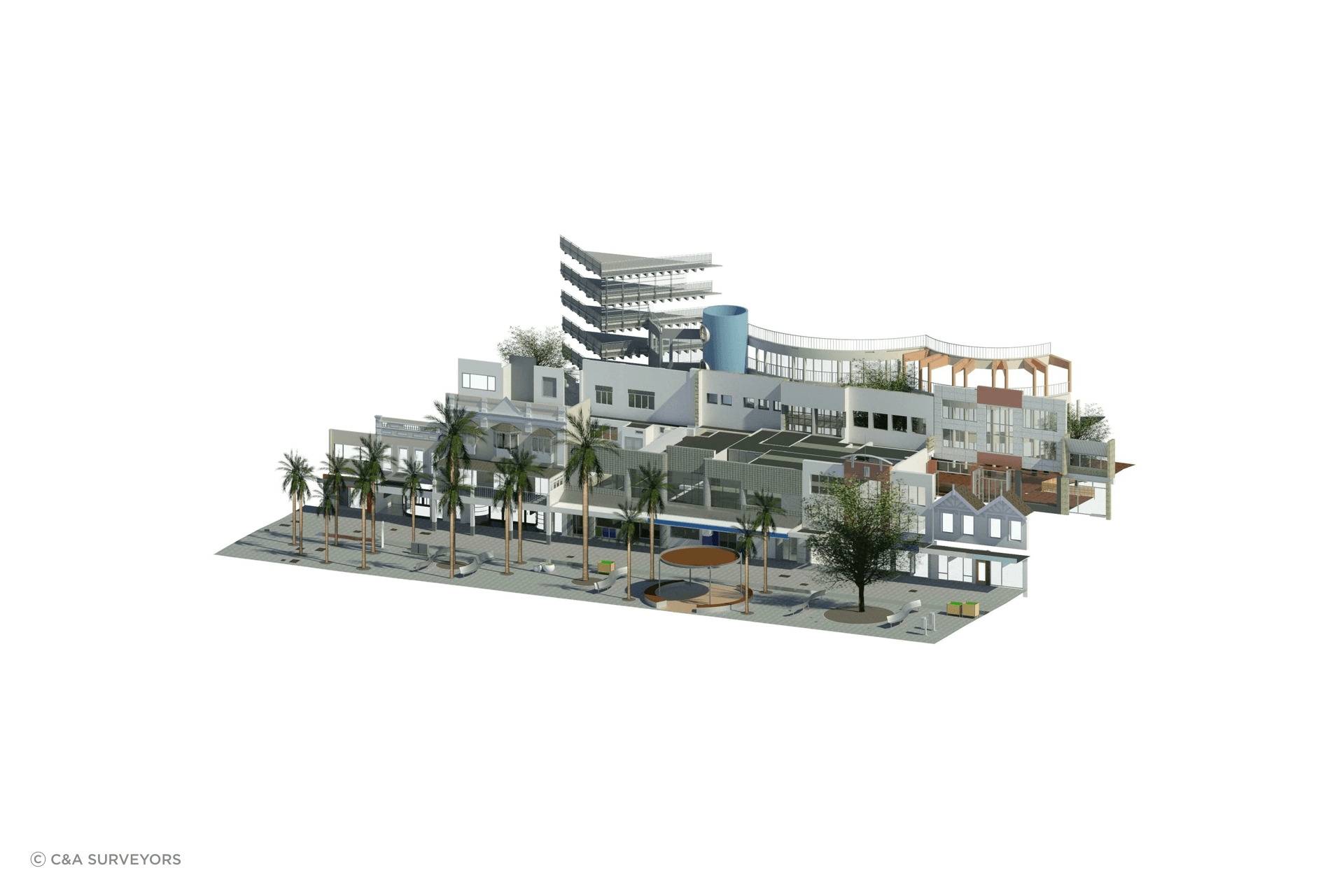
Choosing the right survey for the job
One of the most common misconceptions about surveying is that it’s a one-size-fits-all service. In reality, the type of survey (and the technology used to capture it) is carefully selected by the surveyor based on what the project actually needs to achieve.
C&A Surveyors offer a range of surveying methods, from traditional 2D detail and boundary surveys through to 3D modelling, UAV (drone) surveys and LiDAR remote-sensing techniques. The key, according to Tristan, is not leading with technology for its own sake, but matching the method to the site conditions, access constraints and, critically, the tolerances required for the design and construction that will follow.
“Depending on the survey and what we’re doing, there’ll be specific equipment required to do the job,” he explains. “Some sites might not need a UAV survey because we can access the information we require from the ground. Other sites may require a UAV survey, especially if neighbouring property information is more suitable or there are unsafe site conditions. We select the equipment and how we’re going to do the job based on the type of survey our clients are after.”
For clients and designers, this decision-making can be opaque. Most people engaging a surveyor don’t have a detailed understanding of surveying equipment, or the different accuracy thresholds associated with each method.
Commercial projects tend to be more demanding in this respect. Interfaces with existing infrastructure, services and structural elements like steelwork often come with tight tolerances, and the survey needs to capture data accurately enough to support those constraints. In those scenarios, higher-resolution methods become essential.
Regardless of scale, the right survey can determine whether a project moves forward smoothly or stalls before it truly begins. Early, accurate information allows builders and designers to assess feasibility quickly and make informed decisions before costs escalate. Speed matters too: timely site data helps maintain momentum, particularly in the early stages where delays can compound. To support this, C&A Surveyors offer site attendance within 72 hours across all surveying services, helping project teams get clarity when they need it most.
To encourage better surveying practices at the outset, C&A is also supporting new designers to C&A Surveyors by offering access to our core surveying services (including contour surveys, detail & boundary identification surveys, 3D surveys, UAV surveys and internal surveys) at a heavily subsidised rate*. Valued at up to $4,200, the package is available for $200, with all proceeds donated to the Sydney Children’s Hospital Foundation.
Explore surveying services from C&A Surveyors.
*Terms & Conditions
(1) Offer available to new architects or building designers booking their first job with C&A Surveyors, or have not used C&A Surveyors in +12 months. (2) Offer applies to a single residential site only (not duplex, multi- dwelling, or commercial). (3) Maximum site area: 1,000 sqm. Maximum dwelling size: 2 storeys. (4) Includes one standard 2D survey (Contour/Detail or Detail & Boundary Identification Survey), plus 3D, Internal, and UAV surveys of the same property. (5) All surveys must be completed in a single visit, additional visits or re-surveys are chargeable. (6) UAV survey subject to flight zone restrictions (CASA-regulated areas may limit service). (7) Offer not transferable, not redeemable for cash or credit, and cannot be used with other promotions (e.g. Price Beat Guarantee). (8) Offer valid for eligible projects in Sydney, Greater Sydney, Newcastle, and Wollongong regions. (9) Offer valid until 30 June 2026. (10) All donations will be paid to the Sydney Children’s Hospitals Foundation as a lump sum. (11) Donation receipts will be issued in C&A Surveyors’ name and will not be claimable by the participant for tax purposes. (12) The 72-hour site attendance applies to Contour Surveys, Detail and Boundary Identification Surveys, 3D Surveys, and Internal Surveys. Timeframes are measured from quote acceptance and delays may occur in cases of adverse weather, access restrictions, or complex site conditions. (13) Architect or building designer must register and book using a work domain email address (e.g. @companyname.com); personal email accounts such as Gmail, Outlook, Hotmail, or Yahoo are not eligible.