Your Next Survey Opens in Archicad: Existing Conditions, Modelled by the Surveyor

Every project has a week nobody really bills for.
The survey lands. Someone imports the DWG, sets up the project, and spends the next few days rebuilding existing conditions in Archicad – tracing levels, modelling the built form, resolving what the drawing shows against what the point cloud shows, and making educated calls where neither is definitive.
It's necessary work. It's also work you're doing on the surveyor's behalf.
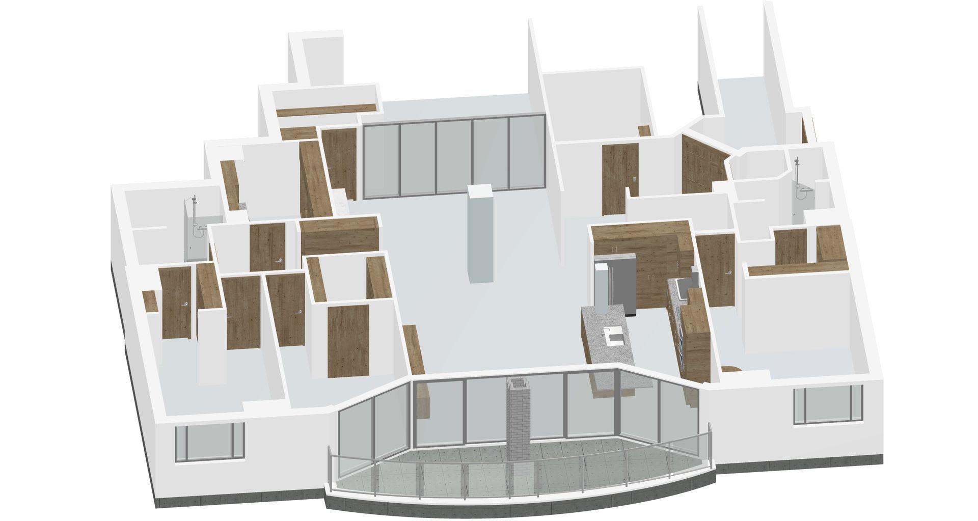
As of last month, that step happens on our side. C&A Surveyors now delivers survey data as a full native Archicad project – modelled by our team from 3D laser scan data, ready to design against. We're the first surveying firm in Australia to do it.
Not an IFC translation. Not a converted model that behaves like a stranger in your file. A native Archicad project, built in the environment your practice already works in.
The bottleneck was never the data
Survey capture has moved a long way. A 3D laser scan records terrain, structure, façade detail and site context in a single pass, at a density no manual pickup can match. The data isn't the constraint.
The handover is.
Survey has traditionally arrived as 2D plans and a DWG – sometimes with a point cloud attached, which most practices treat as a reference layer rather than something they can design with. Either way, the model that ends up driving the project gets built inside the architecture practice, by architectural staff, from someone else's measurements.
That arrangement has two costs.
The first is time, and it lands at the worst possible point in the program – the front end, when the DA clock has already started and the fee has already been quoted.
The second is quieter. Every assumption made during that remodelling exercise becomes a design assumption. A floor level interpolated from a section. A wall thickness taken from a plan rather than a scan. A boundary relationship inferred rather than confirmed. None of it is negligent, and most of it is fine – until one of them isn't, and it surfaces in construction documentation or, worse, on site.
Getting existing conditions modelled by the people who measured them removes both.
What changes in practice
Your project opens with existing conditions already modelled, QA-tested, and built to be designed against.
No import. No format juggling. No rebuild. No guesswork about what the scan was actually showing where the roofline meets the neighbouring wall, because the people who stood on the site made that call – not the person interpreting a drawing three weeks later.
Practices we've worked through this with have put the front-end modelling effort at 30 to 40 hours on a typical residential or small mixed-use project. Close to a full working week, gone before the file is opened.
What you receive
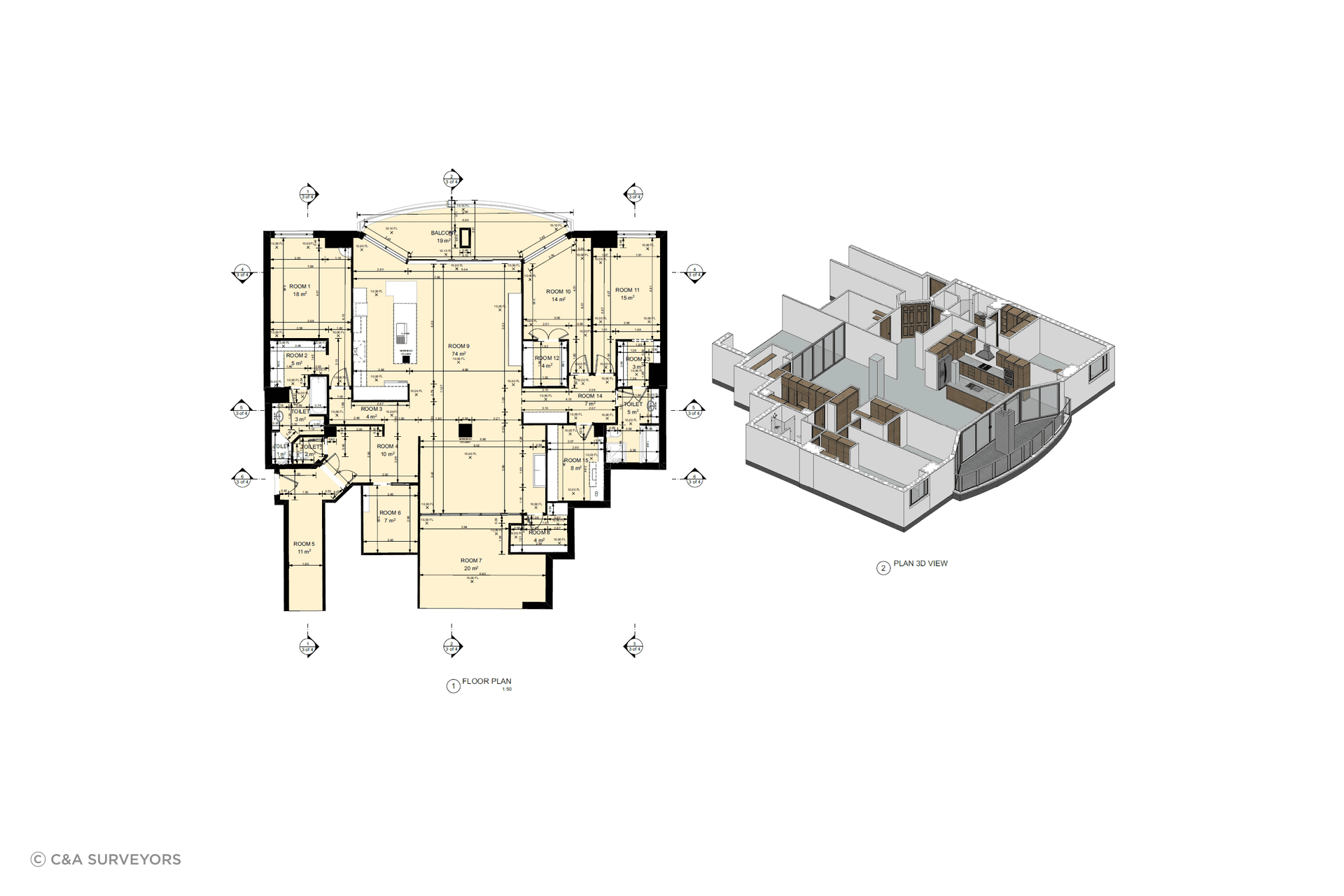
Your 2D set arrives first. PDF and DWG plans on our standard turnaround, so your critical path doesn't move. You can start the same day you always could.
Your native Archicad project follows. Modelled from the 3D laser scan data by our 3D modelling team, then run through our QA process before it reaches you.
Existing conditions ready to design against. Terrain, structure and context, built as a working model rather than a reference underlay.
Revit if you'd rather. We've delivered native Revit models for some time. Choose your platform project by project – it's a delivery option, not a commitment.
Why Archicad, and why now
Because a large share of the practices we work with run it, and because they've been absorbing this cost quietly for years.
The industry conversation about BIM tends to focus on what happens between consultants – coordination, clash detection, federated models. Much less attention goes to the first handover in the chain: the one where measured reality enters the model. That handover has stayed stubbornly analogue. Survey firms measure in 3D and deliver in 2D, and the architect closes the gap.
We've spent the past several years building the in-house capability to close it from our end instead – a dedicated 3D modelling team, laser scanning across residential, commercial and heritage work, and a QA process that treats the model as a deliverable in its own right rather than a by-product of the scan.
Native Archicad delivery is the result. It doesn't make the survey more accurate; our surveys were already accurate. It makes the accuracy usable on day one instead of day five.
How it works
- Book your 3D survey and select Archicad delivery.
- Your PDF and DWG plans arrive on our standard turnaround.
- Your native Archicad project follows – open it and start designing.
Registrations are open for the first intake
We're rolling this out through a limited first intake of practices so we can scope each project properly and refine delivery around how studios actually work. Register your practice and we'll confirm your place and scope your first project with you.
Already have a site in mind? Send us the address and we'll take it from there.
C&A Surveyors has been surveying across Greater Sydney and NSW since 2009. Our team of 60+ staff, including 25+ Surveyors, has completed more than 100,000 projects and holds 450+ five-star reviews. Every survey is completed by, or under the direct supervision of, a registered surveyor – and tracked in real time through C&A Connect, so you always know where your job stands.