LARKI 3D Land Surveys Online

About

Empowering architects, property developers and other built-environment stakeholders to create well-fitted, environmental and affordable buildings through cutting-edge 3D and AI technology.

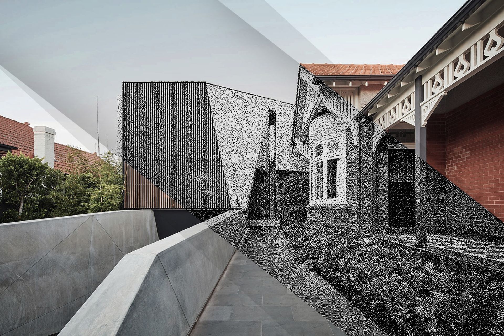
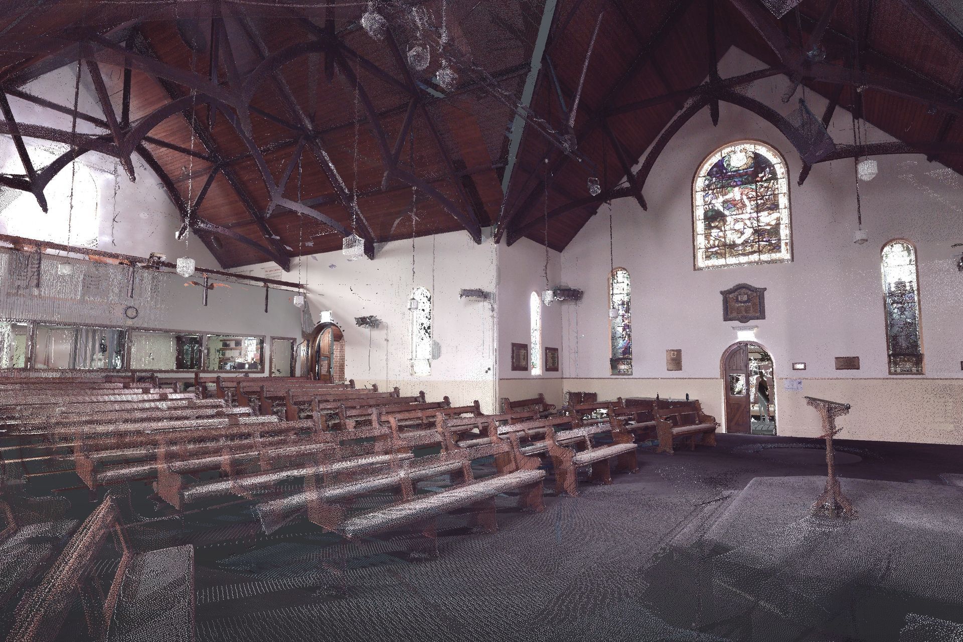
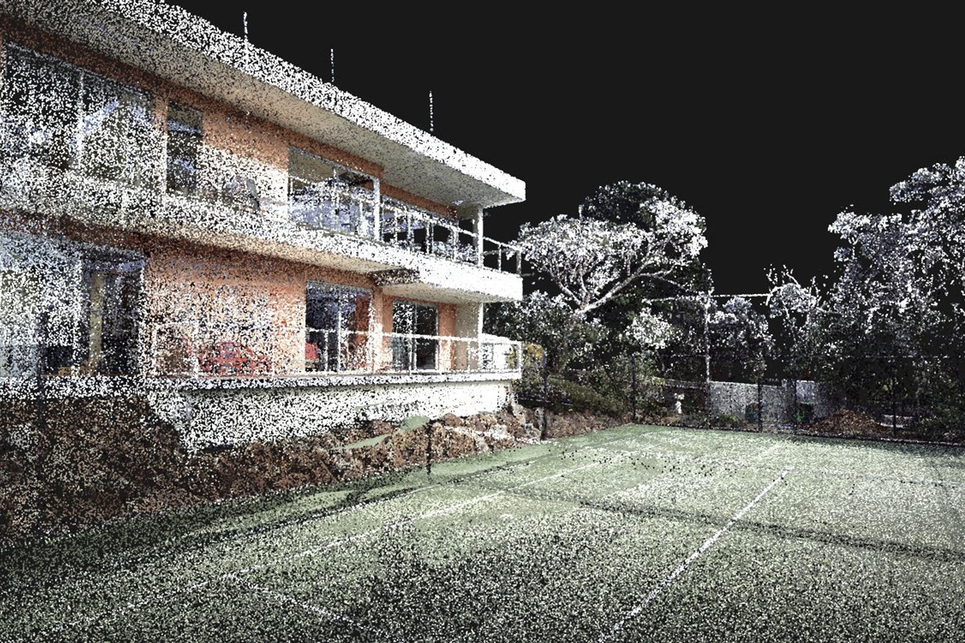
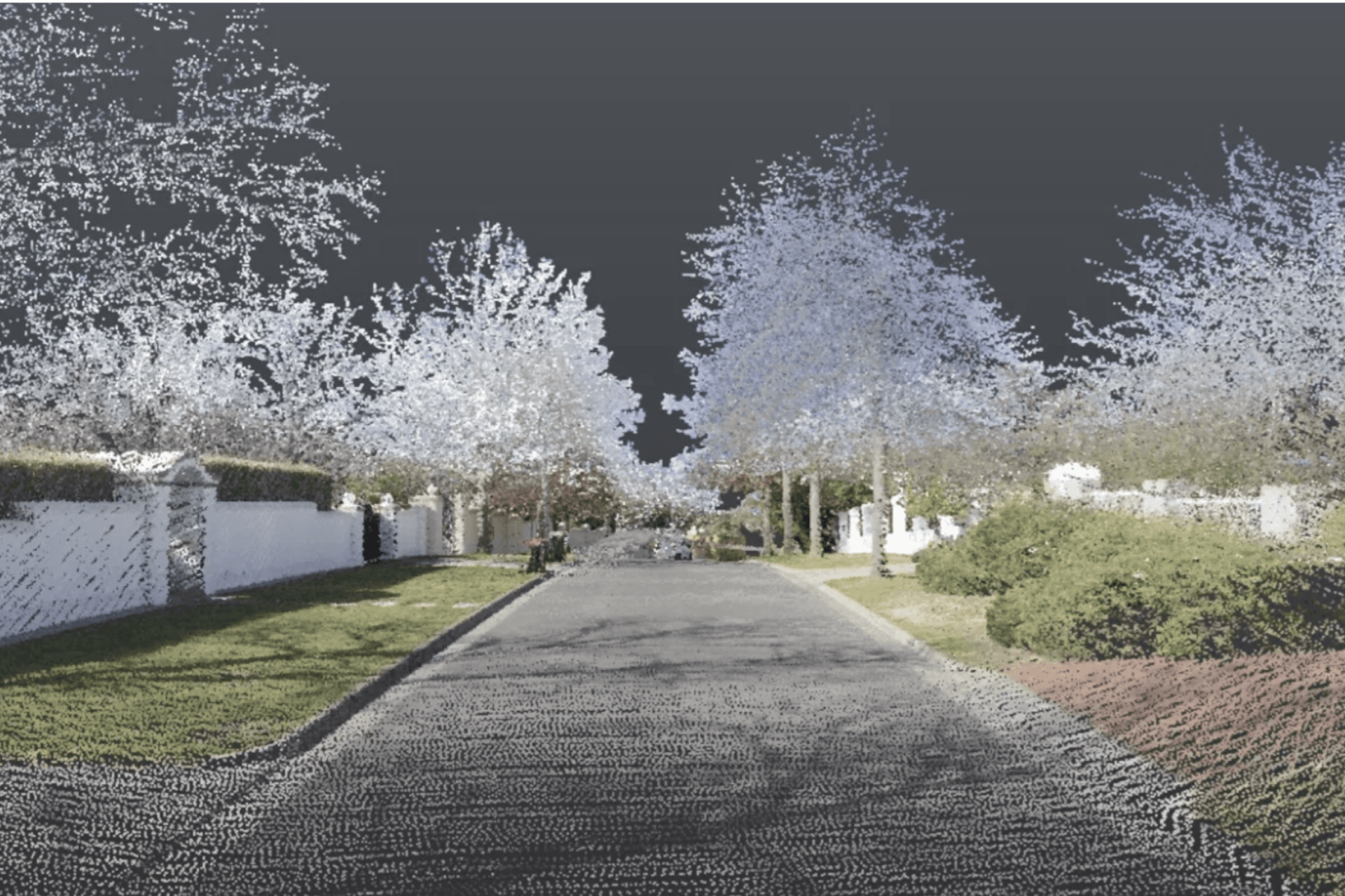
LARKI aggregates 3D laser scan data (LiDAR) captured from planes, cars, drones and tripods. Then rapidly converts to 3D architectural models (BIM).

LARKI supplies 3D laser scanned point clouds of streets and neighbourhoods via an online Platform with a 3D Viewer (SaaS), for professionals who need to do site measurements remotely and fast.

  • Compared to traditional 2D land surveys, LARKI’s 3D Surveys are up to:
  • 300,000 x better resolution,
  • 8 x better value, and
  • 700 x faster to acquire.
  • Saving architects, property owners and property developers weeks and thousands of dollars off their projects.

LARKI makes 3D surveys great value, quick and easy; so that getting approved architectural designs can be affordable, quick and easy; so that great built architecture can be affordable, quick and easy.

Simon Cookes
Simon Cookes
Member

I'm converted! Going to use LARKI 3D point cloud surveys on every job from now on. We are able to get obscure detailed site measurements without having to go to site. For example, identifying clashes of an existing irregular spaced truss from the office in the early design phase of the project. This LARKI 3D survey has made our design and modelling effort so much quicker. Literally saved us days of our time. God sent!

Dominic Piccolo, Director - Piccolo Architecture

LARKI 3D surveys really saved us time. All the necessary information was collected in great detail, allowing us to work with confidence and avoid having to return to the site to re-measure. LARKI 3D surveys is really a game changer.

Petar Petrov, Director & Principal Architect, Petroff Architecture

LARKI has allowed us to design with certainty and precision around existing conditions. We see their point clouds and 3D photogrammetry as essential tools in any architect's workflow. Moving from 2D surveys to point clouds feels like the step from 2D CAD to 3D BIM modeling.

James Murray - Tandem Architecture

We used LARKI 3D Point Clouds, existing conditions 3D modelling and 2D survey information on a particular large project with some areas of complicated construction elements as well as a number of staircases and strange wall positions. The cost of us site-measuring and modelling would have been close to 30-40% more in fees to the client as well as us having to return multiple times to re-measure areas which we would have inevitably missed. The fact that they produced 3D model files compatible to our software, 2D survey information and title re-establishment at a competitive price vs the cost of our existing conditions assessment and modelling, as well as the land surveyors costs made it an easy decision. Where we had to do a bit of cleaning up and formatting to use in our templates but it was minor and the advantage of having the point cloud models meant when overlaid on our active model in 3D would help clarify anything we weren’t sure of as well as being extremely accurate. We could even see the images of posters on the wall from their scans. It was incredibly useful for accurate adjoining building information such as windows and private open space. I will definitely be using Larki again for coming projects, really impressive.

Patrick Jost, Director - Jost Architects

When we engaged LARKI, it was a very quick turn around, within a week, and that's for a lot of information. Traditionally, you’d have to put people out there, set up, get approvals, etc and then the information needs to be manipulated to be available to the architect. With LARKI, it was pretty instantaneous the way LARKI worked through, and in a bid where time is really pressured, it was helpful to get that information across. It’s been beneficial that I can go online and view the model, which is fantastic. I can show people in my team the buildings, how the site works, and actually understand what's available within those walls and how those buildings can be incorporated into our design. We work with global companies, we build everywhere, so having access to data on sites that we can access through the Internet is amazing…. So we love using LARKI.

Charlie Peck - Brookfield - property developer

LARKI's work on Nightingale Village has been exceptional!... So good to see an entrepreneurial architect see a problem in our industry, design a solution, then roll that solution out as a smart new product tailored specifically for us.

Jeremy McLeod, Director - Breathe Architecture
At ArchiPro we recognise and acknowledge the existing, original and ancient connection Aboriginal and Torres Strait Islander peoples have to the lands and waterways across the Australian continent. We pay our respects to the elders past and present. We commit to working together to build a prosperous and inclusive Australia.