
About
3D Aerial Point Cloud.
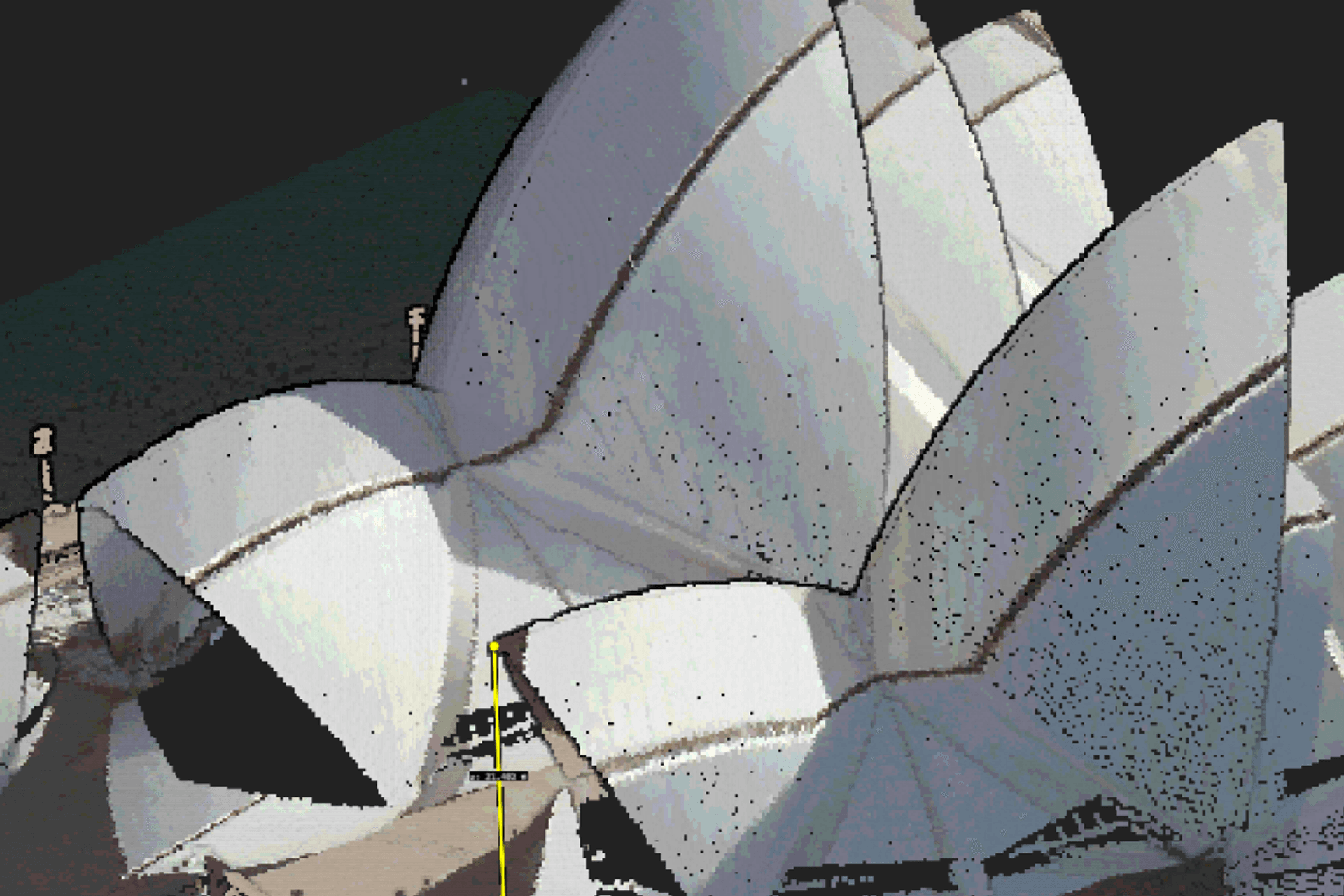
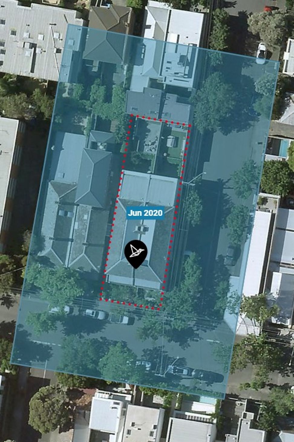
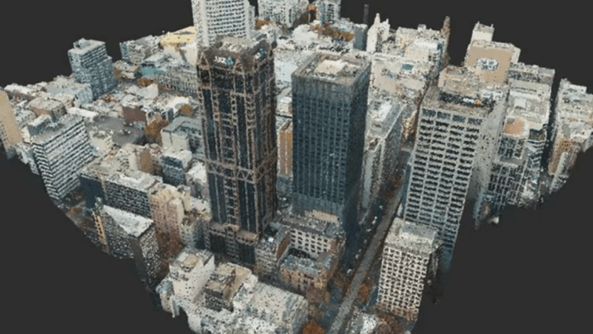
ArchiPro Project Summary - 3D Aerial Point Cloud provides medium-resolution, colorized 3D point cloud data captured via LiDAR, offering architects and planners detailed insights into neighborhoods, topography, and existing structures, with data available across Melbourne and Sydney.
- Title:
- 3D Aerial Point Cloud
- Land Surveyor:
- LARKI 3D Land Surveys Online
- Photographers:
- LARKI 3D Land Surveys Online
Project Gallery


Inspired by this project?Visit LARKI 3D Land Surveys Online

LARKI 3D Land Surveys Online
Land Surveyors
Sydney, City of Sydney, New South Wales
(+1 More)
LARKI 3D Land Surveys Online. Empowering architects, property developers and other built-environment stakeholders to create well-fitted, environmental and affordable buildings through cutting-edge 3D and AI technology.LARKI aggregates 3D laser scan data (LiDAR) captured from planes, cars, drones and tripods. Then rapidly converts to 3D architectural models (BIM).LARKI supplies 3D laser scanned point clouds of streets and neighbourhoods via an online Platform with a 3D Viewer (SaaS), for professionals who need to do site measurements remotely and fast.Compared to traditional 2D land surveys, LARKI’s 3D Surveys are up to:
300,000 x better resolution,
8 x better value, and
700 x faster to acquire.
Saving architects, property owners and property developers weeks and thousands of dollars off their projects.
LARKI makes 3D surveys great value, quick and easy; so that getting approved architectural designs can be affordable, quick and easy; so that great built architecture can be affordable, quick and easy.
Year Joined
2023
Established presence on ArchiPro.
Projects Listed
5
A portfolio of work to explore.

LARKI 3D Land Surveys Online.
Profile
Projects
Contact


Other People also viewed


Why ArchiPro?
No more endless searching -
Everything you need, all in one place.Real projects, real experts -
Work with vetted architects, designers, and suppliers.Designed for Australia -
Projects, products, and professionals that meet local standards.From inspiration to reality -
Find your style and connect with the experts behind it.Start your Project
Start your project with a free account to unlock features designed to help you simplify your building project.
Learn MoreBecome a Pro
Showcase your business on ArchiPro and join industry leading brands showcasing their products and expertise.
Learn More